Durud/The Clock House, The Street, Sedlescombe
Introduction
The photograph on this page of Durud/The Clock House, The Street, Sedlescombe by Simon Carey as part of the Geograph project.
The Geograph project started in 2005 with the aim of publishing, organising and preserving representative images for every square kilometre of Great Britain, Ireland and the Isle of Man.

There are currently over 7.5m images from over 14,400 individuals and you can help contribute to the project by visiting https://www.geograph.org.uk
Durud/The Clock House, The Street, Sedlescombe
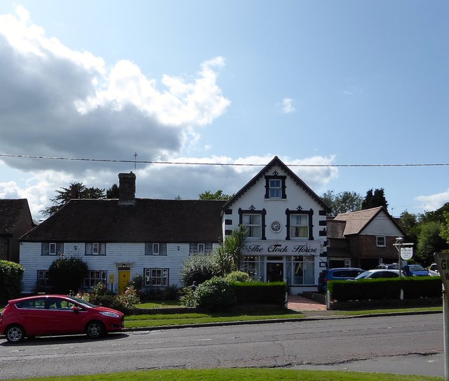
Image: © Simon Carey Taken: 20 Aug 2019
Durud is the weatherboarded house on the left dating from the 16th century. The Clock House to the right was originally an extension of Durud when it served as the village post office prior to the first World War. It is now a hair salon.
Images are licensed for reuse under creativecommons.org/licenses/by-sa/2.0
Image Location
Latitude
50.9334
Longitude
0.53366