Temple Manor - northern fa?ade
Introduction
The photograph on this page of Temple Manor - northern fa?ade by Rob Farrow as part of the Geograph project.
The Geograph project started in 2005 with the aim of publishing, organising and preserving representative images for every square kilometre of Great Britain, Ireland and the Isle of Man.

There are currently over 7.5m images from over 14,400 individuals and you can help contribute to the project by visiting https://www.geograph.org.uk
Temple Manor - northern fa?ade
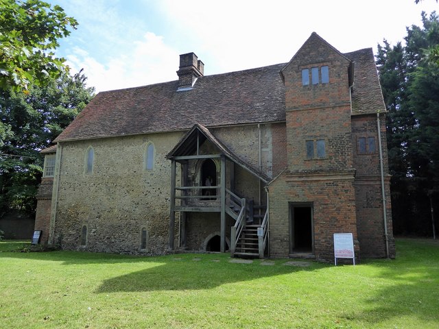
Image: © Rob Farrow Taken: 17 Aug 2019
An early C13th storeyed hall of the Knights Templar later it became a farmhouse and is now an Ancient Monument in the custodianship of English Heritage. One of the many remarkable things about this building is its setting - behind a chain-link fence in the midst of an industrial estate in Strood. See EH Grade I listing here: https://historicengland.org.uk/listing/the-list/list-entry/1120910 Ancient Monument Listing: https://historicengland.org.uk/listing/the-list/list-entry/1011805 English Heritage Visitor information: https://www.english-heritage.org.uk/visit/places/temple-manor See also Image] & Image]
Images are licensed for reuse under creativecommons.org/licenses/by-sa/2.0
Image Location


Leaflet Map data © OpenStreetMap
Latitude
51.389349
Longitude
0.489345