Mills on Britannia Road and the Golcar Aqueduct
Introduction
The photograph on this page of Mills on Britannia Road and the Golcar Aqueduct by Chris Allen as part of the Geograph project.
The Geograph project started in 2005 with the aim of publishing, organising and preserving representative images for every square kilometre of Great Britain, Ireland and the Isle of Man.

There are currently over 7.5m images from over 14,400 individuals and you can help contribute to the project by visiting https://www.geograph.org.uk
Mills on Britannia Road and the Golcar Aqueduct
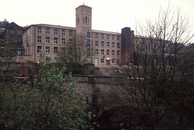
Image: © Chris Allen Taken: 29 Apr 1990
The foreground bridge is the Golcar Aqueduct carrying the Huddersfield Narrow Canal over the Colne (this being the Colne Valley). The background mills are clearly the same as in Humphrey Bolton's Image photograph but with less trees.
Images are licensed for reuse under creativecommons.org/licenses/by-sa/2.0
Image Location
Latitude
53.637888
Longitude
-1.83783