South end of Pilgrim Street
Introduction
The photograph on this page of South end of Pilgrim Street by Robert Graham as part of the Geograph project.
The Geograph project started in 2005 with the aim of publishing, organising and preserving representative images for every square kilometre of Great Britain, Ireland and the Isle of Man.

There are currently over 7.5m images from over 14,400 individuals and you can help contribute to the project by visiting https://www.geograph.org.uk
South end of Pilgrim Street
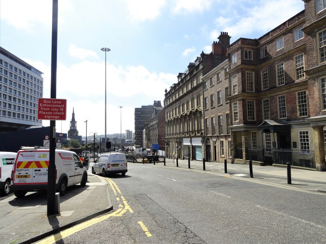
Image: © Robert Graham Taken: 28 Jun 2019
This is the main route south from the city centre of Newcastle, leading onto the Tyne Bridge. The bridge's arch can be seen in the distance in the centre, and All Saints Church on the left. A mixture of C19 and older buildings are on the right.
Images are licensed for reuse under creativecommons.org/licenses/by-sa/2.0
Image Location
Latitude
54.971792
Longitude
-1.610062