96 to 108, Mansfield Road, Nottingham
Introduction
The photograph on this page of 96 to 108, Mansfield Road, Nottingham by Alan Murray-Rust as part of the Geograph project.
The Geograph project started in 2005 with the aim of publishing, organising and preserving representative images for every square kilometre of Great Britain, Ireland and the Isle of Man.

There are currently over 7.5m images from over 14,400 individuals and you can help contribute to the project by visiting https://www.geograph.org.uk
96 to 108, Mansfield Road, Nottingham
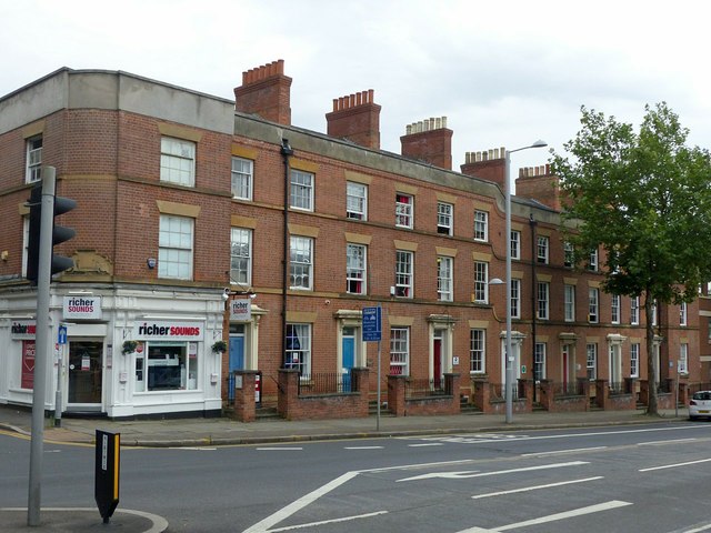
Image: © Alan Murray-Rust Taken: 26 Jul 2019
Terrace of 8 town houses along the main northern arterial road out of Nottingham, built c.1840, Listed Grade II. Mainly converted to offices in the later 20th century, some have now reverted to residential use.
Images are licensed for reuse under creativecommons.org/licenses/by-sa/2.0
Image Location
Latitude
52.960629
Longitude
-1.150209