Crossing point on the Tanfield Railway Path
Introduction
The photograph on this page of Crossing point on the Tanfield Railway Path by Oliver Dixon as part of the Geograph project.
The Geograph project started in 2005 with the aim of publishing, organising and preserving representative images for every square kilometre of Great Britain, Ireland and the Isle of Man.

There are currently over 7.5m images from over 14,400 individuals and you can help contribute to the project by visiting https://www.geograph.org.uk
Crossing point on the Tanfield Railway Path
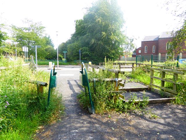
Image: © Oliver Dixon Taken: 24 Jul 2019
Here the Tanfield Railway Path crosses the Whickham Highway B6317 at Lobley Hill with a central refuge in the road. In the foreground are an A-type access control for cyclists and a horse stile.
Images are licensed for reuse under creativecommons.org/licenses/by-sa/2.0
Image Location
Latitude
54.940074
Longitude
-1.640494