The approach to Navvies Bridge
Introduction
The photograph on this page of The approach to Navvies Bridge by Graham Hogg as part of the Geograph project.
The Geograph project started in 2005 with the aim of publishing, organising and preserving representative images for every square kilometre of Great Britain, Ireland and the Isle of Man.

There are currently over 7.5m images from over 14,400 individuals and you can help contribute to the project by visiting https://www.geograph.org.uk
The approach to Navvies Bridge
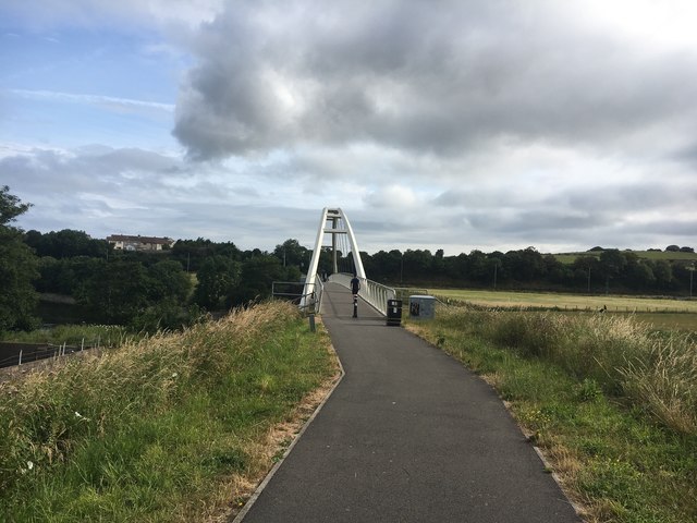
Image: © Graham Hogg Taken: 13 Jul 2019
This pedestrian bridge over the River Derwent was installed in 2011 to replace the bridge washed away by floodwater in November 2009.
Images are licensed for reuse under creativecommons.org/licenses/by-sa/2.0
Image Location
Latitude
54.646066
Longitude
-3.544372