SEPA monitoring station, Glazert Water
Introduction
The photograph on this page of SEPA monitoring station, Glazert Water by Richard Sutcliffe as part of the Geograph project.
The Geograph project started in 2005 with the aim of publishing, organising and preserving representative images for every square kilometre of Great Britain, Ireland and the Isle of Man.

There are currently over 7.5m images from over 14,400 individuals and you can help contribute to the project by visiting https://www.geograph.org.uk
SEPA monitoring station, Glazert Water
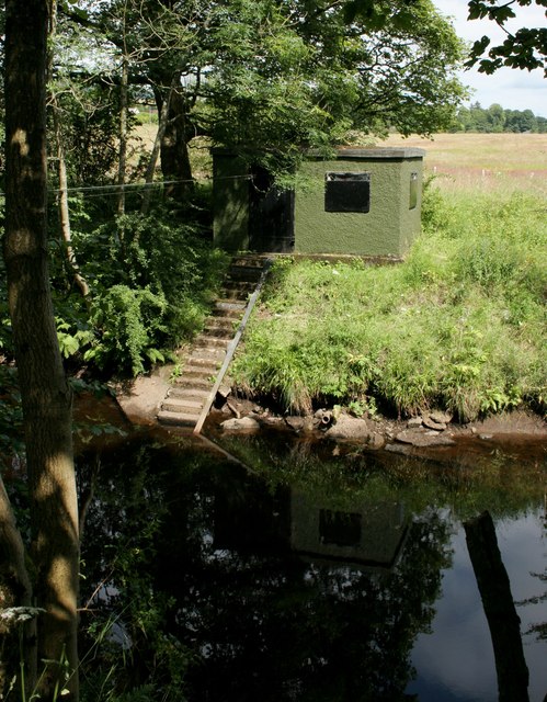
Image: © Richard Sutcliffe Taken: 14 Jul 2019
One of the two river gauging stations on the Glazert Water. It seems to consist of a small square building which has steps leading down to the water. A wire runs across the river from this building to the other bank, and can just be seen on the left side of the photograph. This appears to be some kind of pulley system, presumably for transporting equipment from one side to the other. Immediately dwnstream of here is some sort of weir [https://www.geograph.org.uk/photo/6212909].
Images are licensed for reuse under creativecommons.org/licenses/by-sa/2.0
Image Location
Latitude
55.960822
Longitude
-4.156085