Sherbrooke Mosspark Parish Church
Introduction
The photograph on this page of Sherbrooke Mosspark Parish Church by Richard Sutcliffe as part of the Geograph project.
The Geograph project started in 2005 with the aim of publishing, organising and preserving representative images for every square kilometre of Great Britain, Ireland and the Isle of Man.

There are currently over 7.5m images from over 14,400 individuals and you can help contribute to the project by visiting https://www.geograph.org.uk
Sherbrooke Mosspark Parish Church
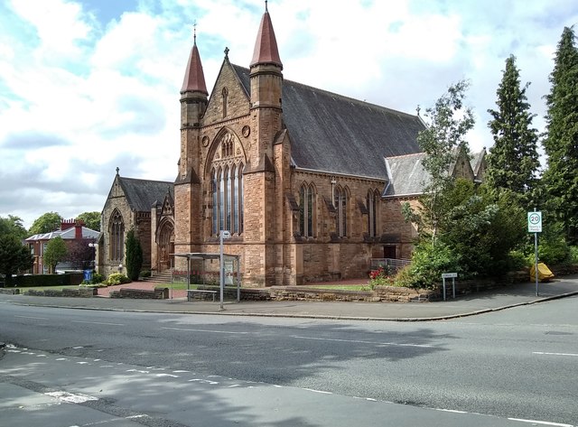
Image: © Richard Sutcliffe Taken: 11 Jul 2019
The Category B listed church [http://portal.historicenvironment.scot/designation/LB33453] was built as Sherbrooke UF Church, and opened in 1900. It was severely damaged by fire in 1994, and has since been extensively restored, including some beautiful modern stained-glass windows [https://www.geograph.org.uk/photo/1672915].
Images are licensed for reuse under creativecommons.org/licenses/by-sa/2.0
Image Location
Latitude
55.843929
Longitude
-4.298321