Sopwell Nunnery Information Board (1)
Introduction
The photograph on this page of Sopwell Nunnery Information Board (1) by David Hillas as part of the Geograph project.
The Geograph project started in 2005 with the aim of publishing, organising and preserving representative images for every square kilometre of Great Britain, Ireland and the Isle of Man.

There are currently over 7.5m images from over 14,400 individuals and you can help contribute to the project by visiting https://www.geograph.org.uk
Sopwell Nunnery Information Board (1)
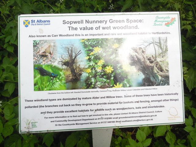
Image: © David Hillas Taken: 30 May 2019
Located on the Abbey Line Trail in Sopwell Nunnery Green Space https://www.walkingenglishman.com/ldp/abbeylinetrail.html refers, this board has been erected by St Albans District Council and has the following wording on it. Sopwell Nunnery Green Space: The value of wet woodland. Also known as Carr Woodland this is an important and rare wet woodland habitat in Hertfordshire. The images in the middle show the following: Clockwise from the bottom left: Banded Demoiselle damselfly, Common Frog, Riverside Willow, Lesser Celandine and Pollarded Willow These woodland types are dominated by mature Alder and Willow trees. Some of these trees have been historically pollarded (the branches cut back so they re-grow to provide material for baskets and fencing, amongst other things) and they provide excellent habitats for wildlife such as woodpeckers, bats and invertebrates.
Images are licensed for reuse under creativecommons.org/licenses/by-sa/2.0
Image Location
Latitude
51.743747
Longitude
-0.332697