
Maryfield House
Introduction
The photograph on this page of Maryfield House by Derek Harper as part of the Geograph project.
The Geograph project started in 2005 with the aim of publishing, organising and preserving representative images for every square kilometre of Great Britain, Ireland and the Isle of Man.

There are currently over 7.5m images from over 14,400 individuals and you can help contribute to the project by visiting https://www.geograph.org.uk
Maryfield House
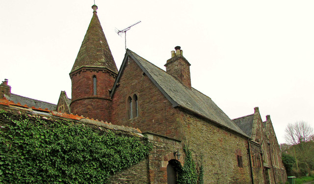
Image: © Derek Harper Taken: 2 Mar 2019
The grade II* listed house https://historicengland.org.uk/listing/the-list/list-entry/1159513 seen from Wilcove Lane. "School, (built shortly after 1847 by W.H. Pole Carew) rebuilt as vicarage for Church of St. Philip and St. James, remodelled by William White c. 1849 altered as 2 houses" - that's a lot that happened in a short time. According to Pevsner & Radcliffe (2nd ed, 1970), the name is "Merifield". See also Image
Images are licensed for reuse under creativecommons.org/licenses/by-sa/2.0
Image Location

Latitude
50.384503
Longitude
-4.218882