Church of St Peter, Peters Marland
Introduction
The photograph on this page of Church of St Peter, Peters Marland by Derek Harper as part of the Geograph project.
The Geograph project started in 2005 with the aim of publishing, organising and preserving representative images for every square kilometre of Great Britain, Ireland and the Isle of Man.

There are currently over 7.5m images from over 14,400 individuals and you can help contribute to the project by visiting https://www.geograph.org.uk
Church of St Peter, Peters Marland
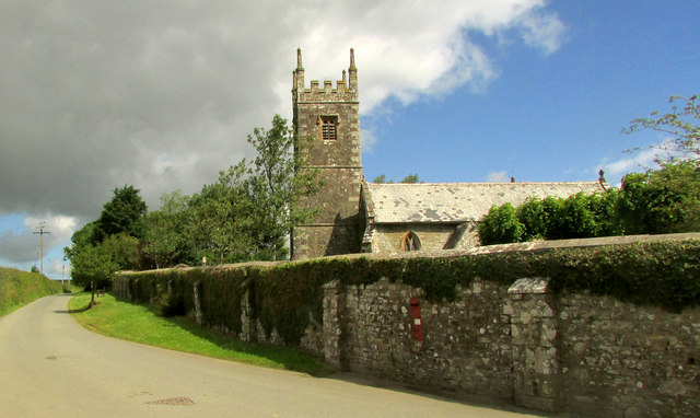
Image: © Derek Harper Taken: 21 Jun 2019
This view of the listed church (see also Image]) also looks up the lane towards Berry Cross. The wall on the right is also part of the listing for the lych gate https://historicengland.org.uk/listing/the-list/list-entry/1162219 with "chamfered coping stones".
Images are licensed for reuse under creativecommons.org/licenses/by-sa/2.0
Image Location
Latitude
50.900685
Longitude
-4.165683