Farmer's Row, The Biggin, Castle Donington
Introduction
The photograph on this page of Farmer's Row, The Biggin, Castle Donington by Alan Murray-Rust as part of the Geograph project.
The Geograph project started in 2005 with the aim of publishing, organising and preserving representative images for every square kilometre of Great Britain, Ireland and the Isle of Man.

There are currently over 7.5m images from over 14,400 individuals and you can help contribute to the project by visiting https://www.geograph.org.uk
Farmer's Row, The Biggin, Castle Donington
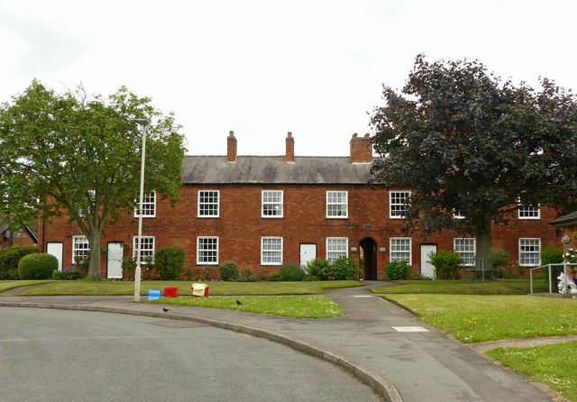
Image: © Alan Murray-Rust Taken: 18 Jun 2019
A row of almshouses, built c.1850, although the plaque http://www.geograph.org.uk/photo/6189669 over the passageway records them a being gifted to Castle Donington in 1901. Listed Grade II. Originally each bay was a separate dwelling, but a number of pairs appear to have been combined.
Images are licensed for reuse under creativecommons.org/licenses/by-sa/2.0
Image Location
Latitude
52.841797
Longitude
-1.334994