Kilbirnie from Glengarnock
Introduction
The photograph on this page of Kilbirnie from Glengarnock by Mark S as part of the Geograph project.
The Geograph project started in 2005 with the aim of publishing, organising and preserving representative images for every square kilometre of Great Britain, Ireland and the Isle of Man.

There are currently over 7.5m images from over 14,400 individuals and you can help contribute to the project by visiting https://www.geograph.org.uk
Kilbirnie from Glengarnock
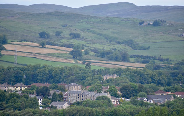
Image: © Mark S Taken: 22 Jun 2019
The prominent building closest to the camera is located on Avils Hill, with the Fudstone scheme behind. In the middle of the picture, nestled in the trees is Moorpark House. To the top right of the photo is a former water treatment plant which after being derelict for many years has been converted into a private residence.
Images are licensed for reuse under creativecommons.org/licenses/by-sa/2.0
Image Location
Latitude
55.751284
Longitude
-4.687144