Fishpool Street
Introduction
The photograph on this page of Fishpool Street by Ian Capper as part of the Geograph project.
The Geograph project started in 2005 with the aim of publishing, organising and preserving representative images for every square kilometre of Great Britain, Ireland and the Isle of Man.

There are currently over 7.5m images from over 14,400 individuals and you can help contribute to the project by visiting https://www.geograph.org.uk
Fishpool Street
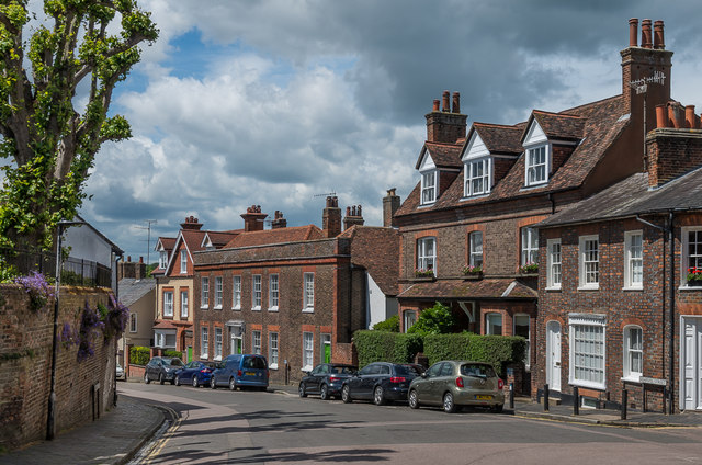
Image: © Ian Capper Taken: 8 Jun 2019
The top end of Fishpool Street seen from Romeland Hill. The long building in the background is 8 and 8a Fishpool Street, the former, Holmhurst, dating from the mid 18th Century and the latter 17th Century but refronted in the mid 18th Century to match its neighbour. Both are grade II listed - see www.historicengland.org.uk/listing/the-list/list-entry/1103138 and www.historicengland.org.uk/listing/the-list/list-entry/1347124 respectively.
Images are licensed for reuse under creativecommons.org/licenses/by-sa/2.0
Image Location
Latitude
51.751831
Longitude
-0.344815