Signal box and trackwork west of Gillingham Level Crossing
Introduction
The photograph on this page of Signal box and trackwork west of Gillingham Level Crossing by Robin Webster as part of the Geograph project.
The Geograph project started in 2005 with the aim of publishing, organising and preserving representative images for every square kilometre of Great Britain, Ireland and the Isle of Man.

There are currently over 7.5m images from over 14,400 individuals and you can help contribute to the project by visiting https://www.geograph.org.uk
Signal box and trackwork west of Gillingham Level Crossing
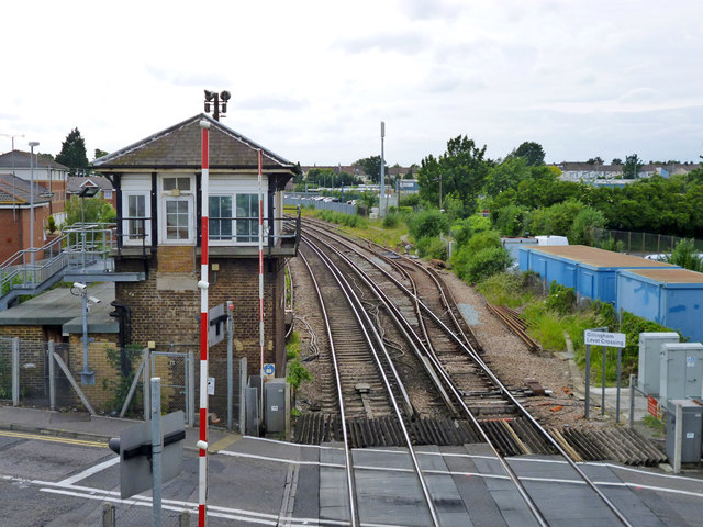
Image: © Robin Webster Taken: 23 Jun 2012
The electrified siding on the right leads to a further non-electrified overgrown siding. From this the Chatham Dockyard Branch diverged, in this 2012 view the connection is still intact.
Images are licensed for reuse under creativecommons.org/licenses/by-sa/2.0
Image Location
Latitude
51.387177
Longitude
0.556784