Kedington houses [3]
Introduction
The photograph on this page of Kedington houses [3] by Michael Dibb as part of the Geograph project.
The Geograph project started in 2005 with the aim of publishing, organising and preserving representative images for every square kilometre of Great Britain, Ireland and the Isle of Man.

There are currently over 7.5m images from over 14,400 individuals and you can help contribute to the project by visiting https://www.geograph.org.uk
Kedington houses [3]
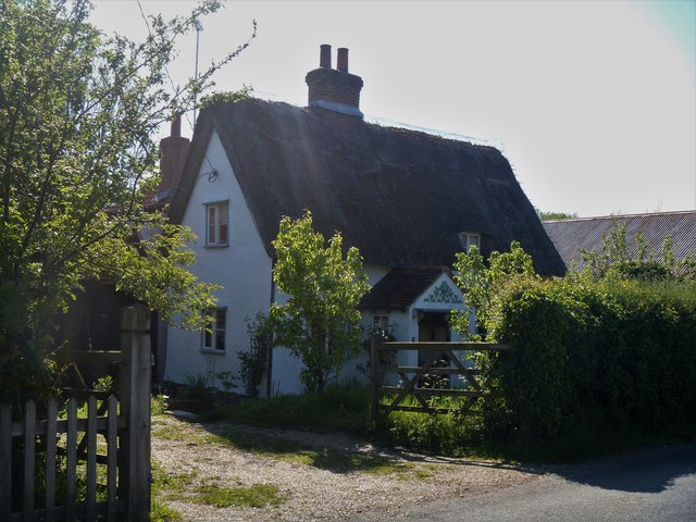
Image: © Michael Dibb Taken: 15 May 2019
White Cottage is late 17th or early 18th century, timber framed, plastered and thatched. Listed, grade II, with details at: https://historicengland.org.uk/listing/the-list/list-entry/1182512
Images are licensed for reuse under creativecommons.org/licenses/by-sa/2.0
Image Location
Latitude
52.092529
Longitude
0.484511