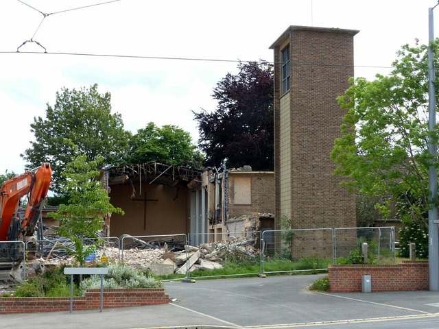
Demolition of St Francis Church, Clifton
Introduction
The photograph on this page of Demolition of St Francis Church, Clifton by Alan Murray-Rust as part of the Geograph project.
The Geograph project started in 2005 with the aim of publishing, organising and preserving representative images for every square kilometre of Great Britain, Ireland and the Isle of Man.
There are currently over 7.5m images from over 14,400 individuals and you can help contribute to the project by visiting https://www.geograph.org.uk

Image: © Alan Murray-Rust Taken: 3 Jun 2019
The church was built during the early 1950s for the then new Clifton estate, largely using volunteer labour to reduce costs. By the 1990s, the fabric of the church was showing signs of deterioration, and with a dwindling congregation no funds were available for repairs. By 2009 the church was closed for worship, although the church hall continued to be used for services. The evangelical Hope Church, which had leased part of the church hall from 2001, moved into its own premises opposite in 2016, and in the same year St Francis merged with Holy Trinity at the southern end of the estate. See http://southwellchurches.history.nottingham.ac.uk/clifton-st-francis/hintro.php for fuller information, and https://www.geograph.org.uk/photo/1069666 for a view of the church when still in use.

