Richleigh, Barton Street, Gloucester
Introduction
The photograph on this page of Richleigh, Barton Street, Gloucester by David Stowell as part of the Geograph project.
The Geograph project started in 2005 with the aim of publishing, organising and preserving representative images for every square kilometre of Great Britain, Ireland and the Isle of Man.

There are currently over 7.5m images from over 14,400 individuals and you can help contribute to the project by visiting https://www.geograph.org.uk
Richleigh, Barton Street, Gloucester
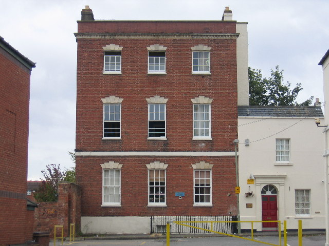
Image: © David Stowell Taken: 2 Oct 2005
The former site of Sir Thomas Rich's school from 1889 to 1964 before it moved to Oxleaze - see Image The blue plaque explains the history and can be seen on more detail on Image
Images are licensed for reuse under creativecommons.org/licenses/by-sa/2.0
Image Location


Leaflet Map data © OpenStreetMap
Latitude
51.863031
Longitude
-2.242468