Footpath, Brompton
Introduction
The photograph on this page of Footpath, Brompton by Danny P Robinson as part of the Geograph project.
The Geograph project started in 2005 with the aim of publishing, organising and preserving representative images for every square kilometre of Great Britain, Ireland and the Isle of Man.

There are currently over 7.5m images from over 14,400 individuals and you can help contribute to the project by visiting https://www.geograph.org.uk
Footpath, Brompton
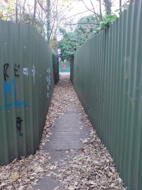
Image: © Danny P Robinson Taken: 18 Nov 2007
This path passes between a fortification ditch on the left and a disused reservoir on the right. It goes between the Officers Tennis Club (ahead) and some now disused hard tennis courts off Kings Bastion Image Access is only possible in the daytime, as there are gates (behind me) that are locked every evening. The red sign at the end says "MOD Property Keep Out", and is on the fence of the Tennis Club. Picture Image was taken looking right from this path.
Images are licensed for reuse under creativecommons.org/licenses/by-sa/2.0
Image Location
Latitude
51.386391
Longitude
0.530867