Westferry railway bridge
Introduction
The photograph on this page of Westferry railway bridge by Thomas Nugent as part of the Geograph project.
The Geograph project started in 2005 with the aim of publishing, organising and preserving representative images for every square kilometre of Great Britain, Ireland and the Isle of Man.

There are currently over 7.5m images from over 14,400 individuals and you can help contribute to the project by visiting https://www.geograph.org.uk
Westferry railway bridge
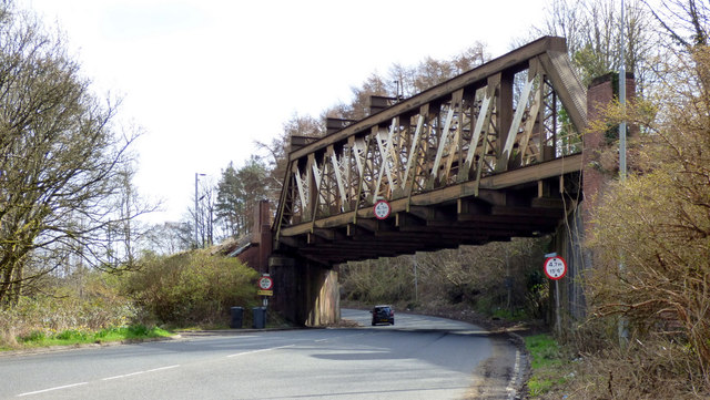
Image: © Thomas Nugent Taken: 25 Mar 2019
The girder bridge carries the Glasgow to Gourock and Wemyss Bay line over the A8 Greenock Road at the foot of Hatton Brae (Bishopton Brae). This is the north side of the bridge.
Images are licensed for reuse under creativecommons.org/licenses/by-sa/2.0
Image Location


Leaflet Map data © OpenStreetMap
Latitude
55.922266
Longitude
-4.555383