World's End Estate
Introduction
The photograph on this page of World's End Estate by Derek Harper as part of the Geograph project.
The Geograph project started in 2005 with the aim of publishing, organising and preserving representative images for every square kilometre of Great Britain, Ireland and the Isle of Man.

There are currently over 7.5m images from over 14,400 individuals and you can help contribute to the project by visiting https://www.geograph.org.uk
World's End Estate
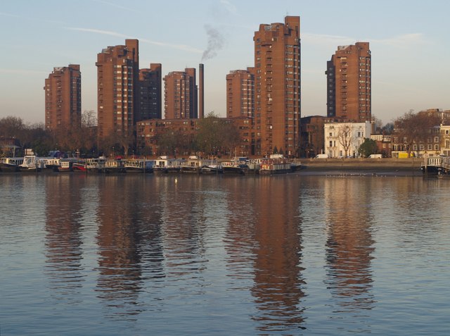
Image: © Derek Harper Taken: 16 Nov 2007
The seven towers, connected by low-rise blocks, were completed in 1977. Chelsea Reach Tower and Greaves Tower (the nearest and furthest) are 20 storeys high; the rest are 18. Seen from across the river on the Thames Path near Paveley Drive.
Images are licensed for reuse under creativecommons.org/licenses/by-sa/2.0
Image Location
Latitude
51.48052
Longitude
-0.179721