Coquetdale
Introduction
The photograph on this page of Coquetdale by Leanmeanmo as part of the Geograph project.
The Geograph project started in 2005 with the aim of publishing, organising and preserving representative images for every square kilometre of Great Britain, Ireland and the Isle of Man.

There are currently over 7.5m images from over 14,400 individuals and you can help contribute to the project by visiting https://www.geograph.org.uk
Coquetdale
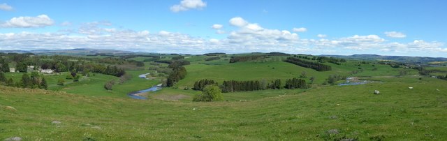
Image: © Leanmeanmo Taken: 22 May 2019
Harehaugh Hill Fort affords one of the very best viewpoints of Coquetdale, where the river changes direction from flowing south to meandering east.
Images are licensed for reuse under creativecommons.org/licenses/by-sa/2.0
Image Location


Leaflet Map data © OpenStreetMap
Latitude
55.295992
Longitude
-2.045484