The approach to Mallaig Station, 1965
Introduction
The photograph on this page of The approach to Mallaig Station, 1965 by Alan Murray-Rust as part of the Geograph project.
The Geograph project started in 2005 with the aim of publishing, organising and preserving representative images for every square kilometre of Great Britain, Ireland and the Isle of Man.

There are currently over 7.5m images from over 14,400 individuals and you can help contribute to the project by visiting https://www.geograph.org.uk
The approach to Mallaig Station, 1965
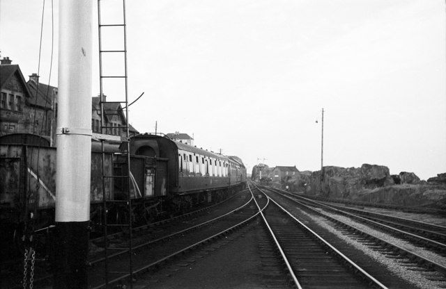
Image: © Alan Murray-Rust Taken: Unknown
Comparing with a modern view http://www.geograph.org.uk/photo/1854911 , much of the track layout has survived (with some modification) because of the need to cater for the locomotive hauled (steam and diesel) special trains which operate on the line.
Images are licensed for reuse under creativecommons.org/licenses/by-sa/2.0
Image Location
Latitude
57.004682
Longitude
-5.83111