Eight Arch Bridge, Bosherton Lakes
Introduction
The photograph on this page of Eight Arch Bridge, Bosherton Lakes by Colin Cheesman as part of the Geograph project.
The Geograph project started in 2005 with the aim of publishing, organising and preserving representative images for every square kilometre of Great Britain, Ireland and the Isle of Man.

There are currently over 7.5m images from over 14,400 individuals and you can help contribute to the project by visiting https://www.geograph.org.uk
Eight Arch Bridge, Bosherton Lakes
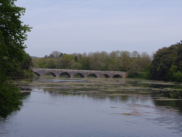
Image: © Colin Cheesman Taken: 15 May 2019
The history of the Bosherston Lakes goes back to around 1760 when the Campbells of Stackpole Court began to lay out a picturesque landscape around their Georgian mansion. Sir John Campbell II dammed a river running through his estate to create three long, slender lakes, with a viewpoint over the lakes from the mansion. In 1797 an elegant bridge was built across one of the lakes to link the house and home farm with the deer park and Stackpole Quay. The Eight Arch Bridge is one of the focal points of Bosherston Lakes, and trails lead from the site of Stackpole Court on one side to Stackpole Warren on the other.
Images are licensed for reuse under creativecommons.org/licenses/by-sa/2.0
Image Location
Latitude
51.62268
Longitude
-4.923615