Public footpath
Introduction
The photograph on this page of Public footpath by Alan Walker as part of the Geograph project.
The Geograph project started in 2005 with the aim of publishing, organising and preserving representative images for every square kilometre of Great Britain, Ireland and the Isle of Man.

There are currently over 7.5m images from over 14,400 individuals and you can help contribute to the project by visiting https://www.geograph.org.uk
Public footpath
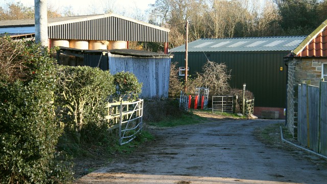
Image: © Alan Walker Taken: 12 Nov 2007
This photograph shows a farm track and public footpath linking Image¹ (just ahead, alongside the green building) with Williamthorpe Road¹ in the Highfields area of Holmewood (behind the viewpoint, northerly). The farm buildings for Timber Lane Farm are built along this track rather than the more traditional/usual farm yard. Ahead, on the left, is a barn providing storage for hay bales. This photograph was taken in November. In the March of the same year the barn was being used as a Image The green building ahead is a Image company. For a photograph taken from the same viewpoint but facing the opposite (south-easterly) direction, click here Image For a more northerly-westerly (behind the viewpoint) photograph of the footpath, click here Image ¹ Road name information from OS Maps at:- Elgin, http://www.elgin.gov.uk/ and the Mapping Portal of the Derbyshire Partnership, http://derbyshiremaps.derbyshire.gov.uk/
Images are licensed for reuse under creativecommons.org/licenses/by-sa/2.0
Image Location
Latitude
53.173748
Longitude
-1.363536