Unofficial footpath, Rhydymwyn
Introduction
The photograph on this page of Unofficial footpath, Rhydymwyn by Alan Murray-Rust as part of the Geograph project.
The Geograph project started in 2005 with the aim of publishing, organising and preserving representative images for every square kilometre of Great Britain, Ireland and the Isle of Man.

There are currently over 7.5m images from over 14,400 individuals and you can help contribute to the project by visiting https://www.geograph.org.uk
Unofficial footpath, Rhydymwyn
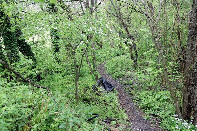
Image: © Alan Murray-Rust Taken: 9 May 2019
This is following the line of the former Mold to Denbigh railway. This closed to general traffic in 1964 but remained open to Hendre Quarry for a further period. The railway has developed into a linear woodland.
Images are licensed for reuse under creativecommons.org/licenses/by-sa/2.0
Image Location
Latitude
53.198259
Longitude
-3.190772