Wellcombe, Goveton
Introduction
The photograph on this page of Wellcombe, Goveton by Derek Harper as part of the Geograph project.
The Geograph project started in 2005 with the aim of publishing, organising and preserving representative images for every square kilometre of Great Britain, Ireland and the Isle of Man.

There are currently over 7.5m images from over 14,400 individuals and you can help contribute to the project by visiting https://www.geograph.org.uk
Wellcombe, Goveton
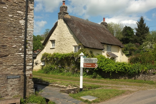
Image: © Derek Harper Taken: 9 May 2019
A listed thatched cottage, "C17 or early C18" https://historicengland.org.uk/listing/the-list/list-entry/1325082, in the hamlet. Between it and the signpost runs the brook referred to in the notice shown in Image
Images are licensed for reuse under creativecommons.org/licenses/by-sa/2.0
Image Location
Latitude
50.304084
Longitude
-3.750724