Stewkley Methodist Church (2)
Introduction
The photograph on this page of Stewkley Methodist Church (2) by David Hillas as part of the Geograph project.
The Geograph project started in 2005 with the aim of publishing, organising and preserving representative images for every square kilometre of Great Britain, Ireland and the Isle of Man.

There are currently over 7.5m images from over 14,400 individuals and you can help contribute to the project by visiting https://www.geograph.org.uk
Stewkley Methodist Church (2)
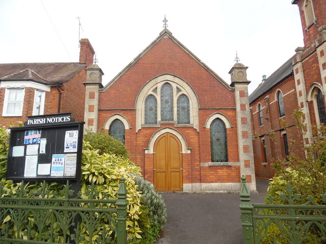
Image: © David Hillas Taken: 12 Apr 2019
Taken in High Street South, this photo shows the church hall with the church itself to the right of the photo. The Parish noticeboard can be seen to the left of the photo. Since September 2006, this church has been a member of the Vale of Aylesbury Methodist Circuit, although it had previously been in the Leighton Buzzard Circuit then the South Bedfordshire Circuit. Incidentally, a Circuit comprises of several Methodist Churches, following which a group of Circuits makes up a Methodist District. In the case of the Vale of Aylesbury Circuit, it is one of twenty three circuits that make up the Northampton District.
Images are licensed for reuse under creativecommons.org/licenses/by-sa/2.0
Image Location
Latitude
51.921846
Longitude
-0.759892