Listullyard Fort Triangulation Pillar
Introduction
The photograph on this page of Listullyard Fort Triangulation Pillar by Rossographer as part of the Geograph project.
The Geograph project started in 2005 with the aim of publishing, organising and preserving representative images for every square kilometre of Great Britain, Ireland and the Isle of Man.

There are currently over 7.5m images from over 14,400 individuals and you can help contribute to the project by visiting https://www.geograph.org.uk
Listullyard Fort Triangulation Pillar
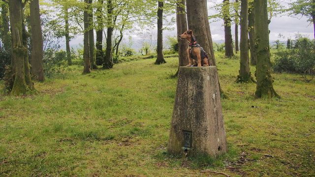
Image: © Rossographer Taken: 3 May 2019
OSNI trig pillar at Listullyard Fort, an ancient rath a few miles outside Banbridge - see Image The pillar sits nicely in the middle of the trees - although the foliage obscures some views the rath is in a commanding position and the hills around Belfast, Slieve Croob, the Mournes, Slieve Gullion and many other hilltops are all visible. The pillar is in good condition but has been splattered with thick blue paint in places. The flush bracket has been levelled to 156.08 metres above MSL Image
Images are licensed for reuse under creativecommons.org/licenses/by-sa/2.0
Image Location
Latitude
54.358439
Longitude
-6.30671