Keeping tabs on Waveland, 2019
Introduction
The photograph on this page of Keeping tabs on Waveland, 2019 by Chris as part of the Geograph project.
The Geograph project started in 2005 with the aim of publishing, organising and preserving representative images for every square kilometre of Great Britain, Ireland and the Isle of Man.

There are currently over 7.5m images from over 14,400 individuals and you can help contribute to the project by visiting https://www.geograph.org.uk
Keeping tabs on Waveland, 2019
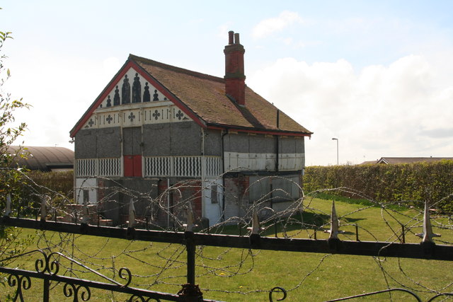
Image: © Chris Taken: 14 Apr 2019
See Image and Image Houses, such as "Waveland", which were built from old railway carriages, were once a common feature of the coastline and countryside, both as residential homes for working class families or as holiday cottages. There are several of these historic grade two listed building along this road, in varying states of repair. In 2012 Waveland was set alight by arsonists. In 2019 there has been no repair work done but protective fencing now surrounds it.
Images are licensed for reuse under creativecommons.org/licenses/by-sa/2.0
Image Location
Latitude
53.3086
Longitude
0.286172