Stable block and kennel at Church Farm
Introduction
The photograph on this page of Stable block and kennel at Church Farm by Richard Law as part of the Geograph project.
The Geograph project started in 2005 with the aim of publishing, organising and preserving representative images for every square kilometre of Great Britain, Ireland and the Isle of Man.

There are currently over 7.5m images from over 14,400 individuals and you can help contribute to the project by visiting https://www.geograph.org.uk
Stable block and kennel at Church Farm
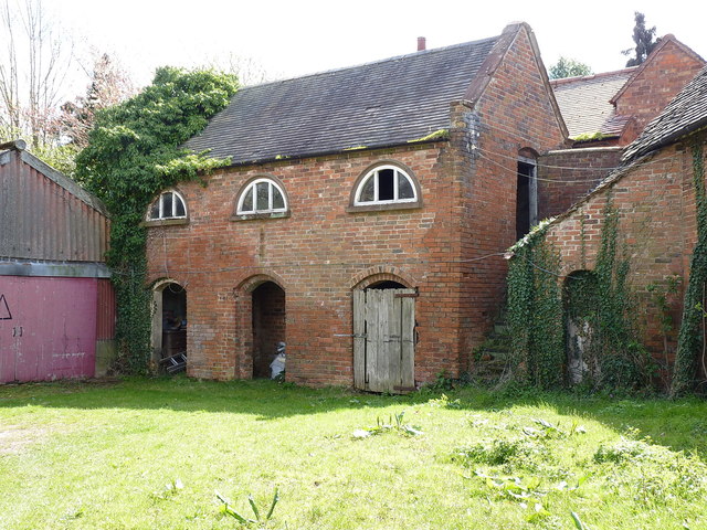
Image: © Richard Law Taken: 11 Apr 2019
Built in the mid 18th century, quite probably around the same time as the Image & Image on the other side of the farmyard, this stableblock and kennel (which lies under the stairs) were also Grade II listed https://britishlistedbuildings.co.uk/101226139-stable-block-and-adjoining-kennel-approximately-30-metres-south-east-of-church-farmhouse-shustoke#.XLHlmehKjcs & https://historicengland.org.uk/listing/the-list/list-entry/1226139 in 1988.
Images are licensed for reuse under creativecommons.org/licenses/by-sa/2.0
Image Location
Latitude
52.51536
Longitude
-1.643789