Old Milestone by the B4019, Stubb's Hill, Burytown
Introduction
The photograph on this page of Old Milestone by the B4019, Stubb's Hill, Burytown by Milestone Society as part of the Geograph project.
The Geograph project started in 2005 with the aim of publishing, organising and preserving representative images for every square kilometre of Great Britain, Ireland and the Isle of Man.

There are currently over 7.5m images from over 14,400 individuals and you can help contribute to the project by visiting https://www.geograph.org.uk
Old Milestone by the B4019, Stubb's Hill, Burytown
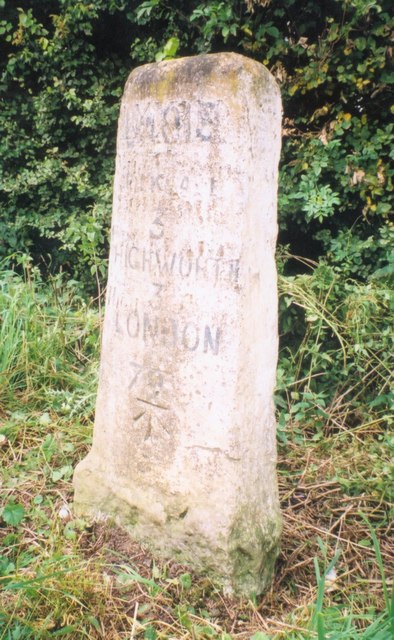
Image: © Milestone Society Taken: Unknown
Highworth Old London Road stone by the B4019, in parish of Blunsdon St Andrew (Swindon District), Castle Hill Court, Burytown, East of Broad Blunsdon, on broad grass verge. Inscription reads:- B4019 CRICKLADE 3 HIGHWORTH 3 LONDON 79 Carved benchmark on lower face. Grade II listed. List Entry Number: 1355996 https://historicengland.org.uk/listing/the-list/list-entry/1355996 Surveyed Milestone Society National ID: WI_lbf79
Images are licensed for reuse under creativecommons.org/licenses/by-sa/2.0
Image Location
Latitude
51.616229
Longitude
-1.763348