Old Milestone by the B4006, Swindon Road, Lower Stratton
Introduction
The photograph on this page of Old Milestone by the B4006, Swindon Road, Lower Stratton by Milestone Society as part of the Geograph project.
The Geograph project started in 2005 with the aim of publishing, organising and preserving representative images for every square kilometre of Great Britain, Ireland and the Isle of Man.

There are currently over 7.5m images from over 14,400 individuals and you can help contribute to the project by visiting https://www.geograph.org.uk
Old Milestone by the B4006, Swindon Road, Lower Stratton
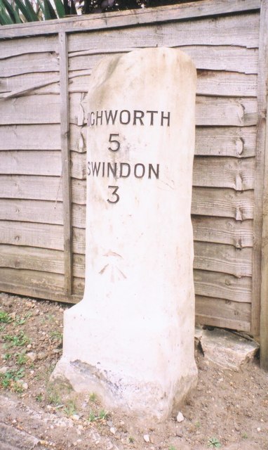
Image: © Milestone Society Taken: Unknown
Swindon half-round stone by the B4006, in parish of Stratton St Margaret (Swindon District), Lower Stratton, outside No. 161 Swindon Road, in front of fence, behind tarmac footpath. Inscription reads:- HIGHWORTH 5 SWINDON 3 Carved benchmark on face. Surveyed Milestone Society National ID: WI_SNLC02
Images are licensed for reuse under creativecommons.org/licenses/by-sa/2.0
Image Location
Latitude
51.576098
Longitude
-1.753051