Old Toll House, Bromfield Road, Ludlow
Introduction
The photograph on this page of Old Toll House, Bromfield Road, Ludlow by Milestone Society as part of the Geograph project.
The Geograph project started in 2005 with the aim of publishing, organising and preserving representative images for every square kilometre of Great Britain, Ireland and the Isle of Man.

There are currently over 7.5m images from over 14,400 individuals and you can help contribute to the project by visiting https://www.geograph.org.uk
Old Toll House, Bromfield Road, Ludlow
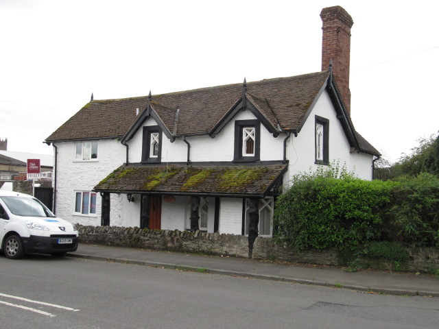
Image: © Milestone Society Taken: Unknown
Toll House by the B4361, in the parish of Ludlow, Tollgate (or Burway) Cottage, Bromfield Road. Grade II listed. List Entry Number: 1282002 https://historicengland.org.uk/listing/the-list/list-entry/1282002 Surveyed Milestone Society National ID: SA.LUD02
Images are licensed for reuse under creativecommons.org/licenses/by-sa/2.0
Image Location
Latitude
52.374456
Longitude
-2.722702