Old Milestone by Hartcliff Road, Paw Hill
Introduction
The photograph on this page of Old Milestone by Hartcliff Road, Paw Hill by C Minto as part of the Geograph project.
The Geograph project started in 2005 with the aim of publishing, organising and preserving representative images for every square kilometre of Great Britain, Ireland and the Isle of Man.

There are currently over 7.5m images from over 14,400 individuals and you can help contribute to the project by visiting https://www.geograph.org.uk
Old Milestone by Hartcliff Road, Paw Hill
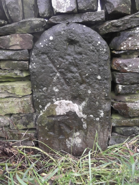
Image: © C Minto Taken: 13 Jul 2002
Carved stone post by the UC road, in parish of Penistone (Barnsley District), Hartcliff Road, East of Fullshaw crossroads with the A628, set in base of wall, opposite entrance to Pawhill Farm, on North side of road. Erected by an unknown authority in the 18th century. N.B. Recorded as a Boundary Stone by the O.S., but listed as a Milestone by Historic England: "(the) old salt route from Cheshire - Hartcliffe Road became a turnpike road in 1741" Inscription reads:- XVI (To Rotherham) Carved benchmark on bottom left corner. Grade II listed. List Entry Number: 1151034 https://historicengland.org.uk/listing/the-list/list-entry/1151034 Milestone Society National ID: YS_RMWH16
Images are licensed for reuse under creativecommons.org/licenses/by-sa/2.0
Image Location
Latitude
53.510658
Longitude
-1.680741