Direction Sign - Signpost in Ranskill
Introduction
The photograph on this page of Direction Sign - Signpost in Ranskill by Milestone Society as part of the Geograph project.
The Geograph project started in 2005 with the aim of publishing, organising and preserving representative images for every square kilometre of Great Britain, Ireland and the Isle of Man.

There are currently over 7.5m images from over 14,400 individuals and you can help contribute to the project by visiting https://www.geograph.org.uk
Direction Sign - Signpost in Ranskill
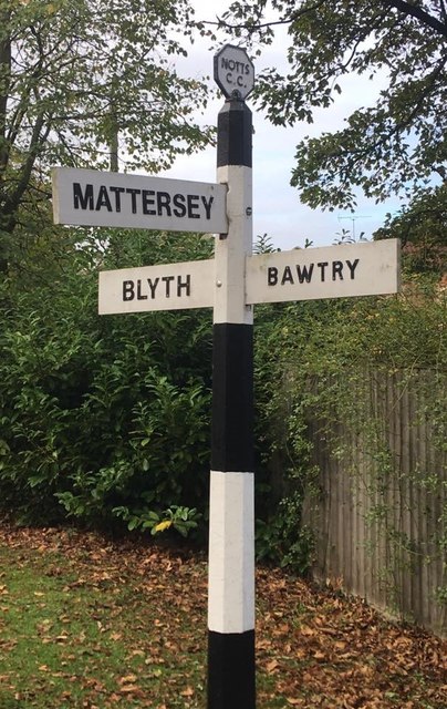
Image: © Milestone Society Taken: Unknown
Octagon finial - 2 arms; by the UC road, in parish of Ranskill (Bassetlaw District), Mattersey Road junction with Folly Nook Lane, Ranskill. Surveyed Milestone Society National ID: NT_SK6588
Images are licensed for reuse under creativecommons.org/licenses/by-sa/2.0
Image Location
Latitude
53.387418
Longitude
-1.010247