Old Milestone by the A5, east of Dinmael
Introduction
The photograph on this page of Old Milestone by the A5, east of Dinmael by Milestone Society as part of the Geograph project.
The Geograph project started in 2005 with the aim of publishing, organising and preserving representative images for every square kilometre of Great Britain, Ireland and the Isle of Man.

There are currently over 7.5m images from over 14,400 individuals and you can help contribute to the project by visiting https://www.geograph.org.uk
Old Milestone by the A5, east of Dinmael
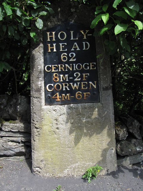
Image: © Milestone Society Taken: Unknown
Telford Plate by the A5, in parish of Maerdy (Conwy County Borough District), Dinmael, in wall and path. Inscription reads:- HOLY- HEAD 62 CERNIOGE 8M-2F CORWEN 4M-6F Rivet benchmark on top. Surveyed Milestone Society National ID: DEN_HH62
Images are licensed for reuse under creativecommons.org/licenses/by-sa/2.0
Image Location
Latitude
52.991689
Longitude
-3.478166