Old Milestone by the A459, Clarence Street in Upper Gornal
Introduction
The photograph on this page of Old Milestone by the A459, Clarence Street in Upper Gornal by M Faherty as part of the Geograph project.
The Geograph project started in 2005 with the aim of publishing, organising and preserving representative images for every square kilometre of Great Britain, Ireland and the Isle of Man.

There are currently over 7.5m images from over 14,400 individuals and you can help contribute to the project by visiting https://www.geograph.org.uk
Old Milestone by the A459, Clarence Street in Upper Gornal
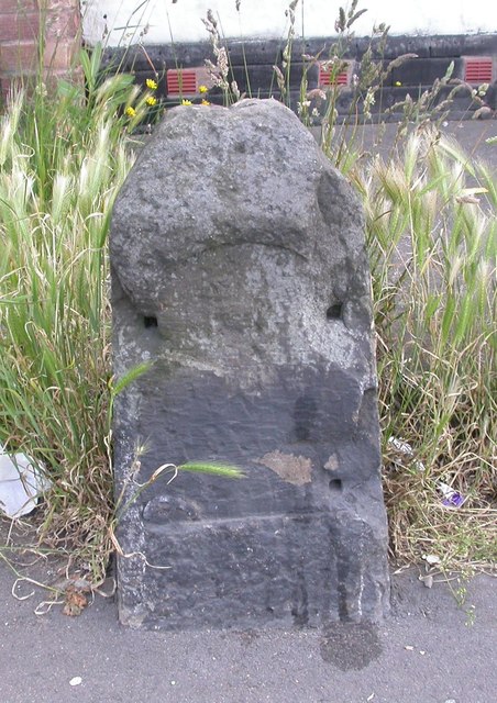
Image: © M Faherty Taken: 11 Jun 2007
Stone post (plate lost) by the A459, in parish of Dudley (Dudley District), Clarence Street; Upper Gornal; 10m East of junction with Moden Hill, by No. 9, by the road, on East side of road. Erected by the Dudley & Wolverhampton turnpike trust in the 19th century. Inscription once read:- (Wolverhampton 4) (Dudley 2) Milestone Society National ID: ST_WVDL04
Images are licensed for reuse under creativecommons.org/licenses/by-sa/2.0
Image Location
Latitude
52.531352
Longitude
-2.118963