Old railway bridge abutment
Introduction
The photograph on this page of Old railway bridge abutment by Alan Walker as part of the Geograph project.
The Geograph project started in 2005 with the aim of publishing, organising and preserving representative images for every square kilometre of Great Britain, Ireland and the Isle of Man.

There are currently over 7.5m images from over 14,400 individuals and you can help contribute to the project by visiting https://www.geograph.org.uk
Old railway bridge abutment
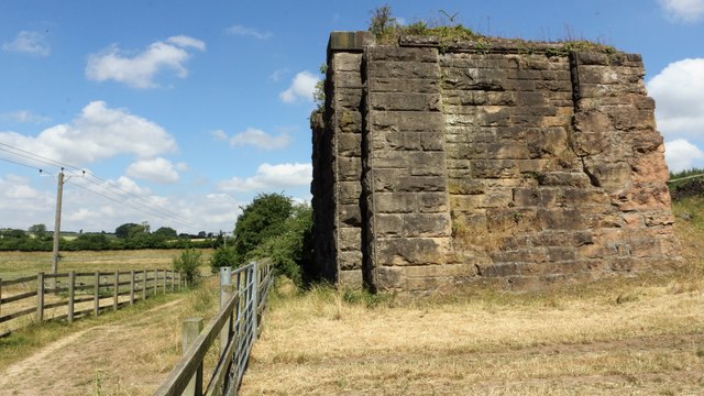
Image: © Alan Walker Taken: 3 Jul 2018
This abutment is all that remains of a bridge that once carried the Leen Valley Extension Railway over Image The Leen Valley Extension Railway was built by the Great Northern Railway to provide the company with access to the coal workings in the area. The railway ran from Kirkby South Junction to Langwith Junction. Reference:- https://www.pastscape.org.uk/hob.aspx?hob_id=316103 . An OS map dated 1937-61 from the National Library of Scotland https://maps.nls.uk/geo/explore/side-by-side/#zoom=15&lat=53.1853&lon=-1.2347&layers=10&right=osm shows the point at which the railway crossed Forge Lane. Today the old track-bed provides the basis for the Image, including a branch line that ran to the Silverhill and Teversal collieries and now forms the Image *** See also these photographs by Chris Morgan:- Image, James Hill:- Image and John Slater:- Image
Images are licensed for reuse under creativecommons.org/licenses/by-sa/2.0
Image Location
Latitude
53.18495
Longitude
-1.235272