Old Milepost by the B2026, Eastbourne Road, Uckfield
Introduction
The photograph on this page of Old Milepost by the B2026, Eastbourne Road, Uckfield by Keith Sharp as part of the Geograph project.
The Geograph project started in 2005 with the aim of publishing, organising and preserving representative images for every square kilometre of Great Britain, Ireland and the Isle of Man.

There are currently over 7.5m images from over 14,400 individuals and you can help contribute to the project by visiting https://www.geograph.org.uk
Old Milepost by the B2026, Eastbourne Road, Uckfield
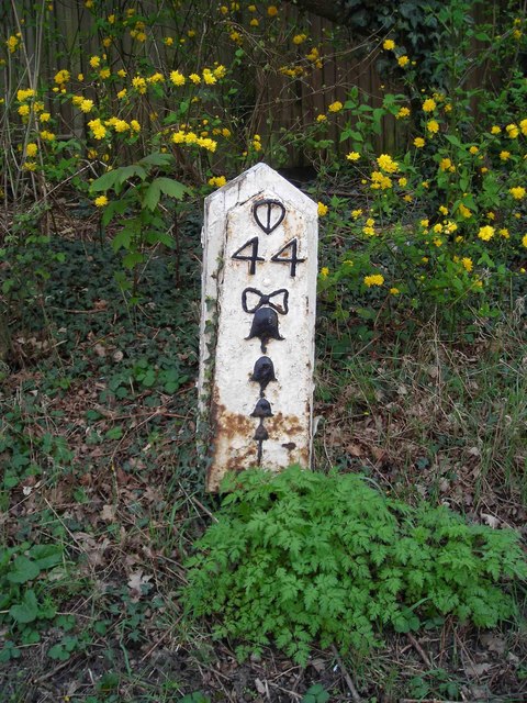
Image: © Keith Sharp Taken: 13 Apr 2008
Metal plate attached to wooden post by the B2026 (was A22), in parish of Uckfield (Wealden District), Eastbourne Road, between Timberley Gardens and Meadow View, in hedge between '40' sign and bus shelter, on West side of road. Bow Bells and Buckle iron plate, erected by the Horsebridge & Horeham turnpike trust in the 19th century. Inscription reads:- {Pelham Buckle} 44 {Bow & 4 Bells} East Sussex HER. HER Ref: MES21806 https://www.heritagegateway.org.uk/Gateway/Results_Single.aspx?uid=MES21806&resourceID=1026 Milestone Society National ID: SX_LLE44
Images are licensed for reuse under creativecommons.org/licenses/by-sa/2.0
Image Location
Latitude
50.958436
Longitude
0.106569