Old Milestone by the A487, Rhydyfelin, Llanfarian parish
Introduction
The photograph on this page of Old Milestone by the A487, Rhydyfelin, Llanfarian parish by Milestone Society as part of the Geograph project.
The Geograph project started in 2005 with the aim of publishing, organising and preserving representative images for every square kilometre of Great Britain, Ireland and the Isle of Man.

There are currently over 7.5m images from over 14,400 individuals and you can help contribute to the project by visiting https://www.geograph.org.uk
Old Milestone by the A487, Rhydyfelin, Llanfarian parish
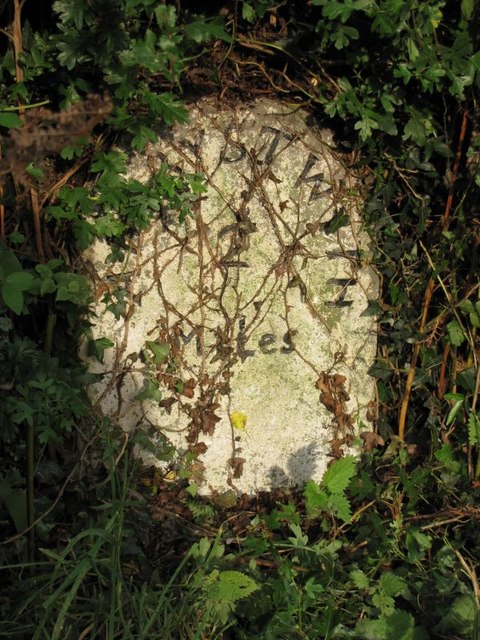
Image: © Milestone Society Taken: Unknown
Aberystwyth tombstone by the A487, in parish of Llanfarian (Ceredigion District), Rhydyfelin, near Crugyn Dimai, in hedge, West side of road. Inscription reads:- ABERYSTWYTH 2 Miles Grade II listed by Cadw. Reference Number: 82507 https://cadwpublic-api.azurewebsites.net/reports/listedbuilding/FullReport?lang=&id=82507 Surveyed Milestone Society National ID: CRD_AYCA02
Images are licensed for reuse under creativecommons.org/licenses/by-sa/2.0
Image Location


Leaflet Map data © OpenStreetMap
Latitude
52.389249
Longitude
-4.07088