Old Milestone by the A91, Low Road, Auchtermuchty
Introduction
The photograph on this page of Old Milestone by the A91, Low Road, Auchtermuchty by Milestone Society as part of the Geograph project.
The Geograph project started in 2005 with the aim of publishing, organising and preserving representative images for every square kilometre of Great Britain, Ireland and the Isle of Man.

There are currently over 7.5m images from over 14,400 individuals and you can help contribute to the project by visiting https://www.geograph.org.uk
Old Milestone by the A91, Low Road, Auchtermuchty
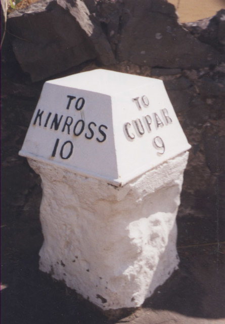
Image: © Milestone Society Taken: Unknown
'C' type by the A91, in parish of Auchtermuchty (Fife District), Auchtermuchty, Low Road, by wall, 300m West of B936 junction, opposite The Bungalow. Inscription reads:- : TO / KINROSS / 10 : : TO / CUPAR / 9 : Surveyed Milestone Society National ID: FF_CPKR09
Images are licensed for reuse under creativecommons.org/licenses/by-sa/2.0
Image Location
Latitude
56.290276
Longitude
-3.233702