Old Milestone by the A429, Malmesbury Road, Kington Langley
Introduction
The photograph on this page of Old Milestone by the A429, Malmesbury Road, Kington Langley by Paul Gilman as part of the Geograph project.
The Geograph project started in 2005 with the aim of publishing, organising and preserving representative images for every square kilometre of Great Britain, Ireland and the Isle of Man.

There are currently over 7.5m images from over 14,400 individuals and you can help contribute to the project by visiting https://www.geograph.org.uk
Old Milestone by the A429, Malmesbury Road, Kington Langley
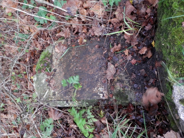
Image: © Paul Gilman Taken: 14 Nov 2015
Metal plate attached to stone post by the A429, in parish of Kington Langley (North Wiltshire District), Malmesbury Road, 40m South of Hillside bungalow, by the road - on its back, said to be in 3 pieces Oct 2015, on East side of road. Chippenham plate, erected by the Malmesbury - First District turnpike trust in the 19th century. Inscription reads:- To Chippenham 3 Grade II listed. List Entry Number: 1198879 https://historicengland.org.uk/listing/the-list/list-entry/1198879 Milestone Society National ID: WI_CPMY03
Images are licensed for reuse under creativecommons.org/licenses/by-sa/2.0
Image Location


Leaflet Map data © OpenStreetMap
Latitude
51.499737
Longitude
-2.125212