Old Wayside Cross, Mannamead Road, Plymouth
Introduction
The photograph on this page of Old Wayside Cross, Mannamead Road, Plymouth by Alan Rosevear as part of the Geograph project.
The Geograph project started in 2005 with the aim of publishing, organising and preserving representative images for every square kilometre of Great Britain, Ireland and the Isle of Man.

There are currently over 7.5m images from over 14,400 individuals and you can help contribute to the project by visiting https://www.geograph.org.uk
Old Wayside Cross, Mannamead Road, Plymouth
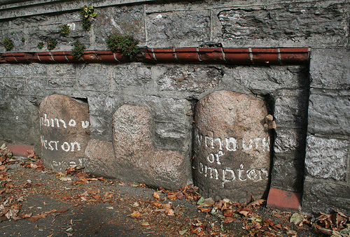
Image: © Alan Rosevear Taken: 20 Oct 2010
Compton Cross, old head and shaft by B3250 road, in parish of Plymouth (Plymouth District), Mannamead Road, 50m Northwest of Lockington Avenue, opposite Torr Lane, low down in wall above path by road; cemented in wall next to tithe boundary markers. See http://www.geograph.org.uk/photo/6061028 for information on parish boundary markers. Surveyed Milestone Society National ID: DVPL_PLY04
Images are licensed for reuse under creativecommons.org/licenses/by-sa/2.0
Image Location
Latitude
50.393638
Longitude
-4.132567