Forge Lane
Introduction
The photograph on this page of Forge Lane by Alan Walker as part of the Geograph project.
The Geograph project started in 2005 with the aim of publishing, organising and preserving representative images for every square kilometre of Great Britain, Ireland and the Isle of Man.

There are currently over 7.5m images from over 14,400 individuals and you can help contribute to the project by visiting https://www.geograph.org.uk
Forge Lane
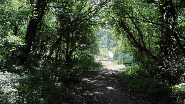
Image: © Alan Walker Taken: 3 Jul 2018
The photograph is looking toward the southern end of Forge Lane and the beginning of a metalled surface just beyond the gate. The metalled surface is one of two short sections of the lane that remain in this condition; the other section being near Image’s intersection with the B6407, the Pleasley to Shirebrook road. Beyond the gate the lane passes some industrial units and then shares a junction with Outgang Lane in Pleasley Vale. Although this is now a bridleway an OS map dated 1937-61 from the National Library of Scotland (https://maps.nls.uk/geo/explore/side-by-side/#zoom=16&lat=53.1818&lon=-1.2321&layers=10&right=osm) shows Forge Lane as being a single-track road between the B6407 and Pleasley Vale.
Images are licensed for reuse under creativecommons.org/licenses/by-sa/2.0
Image Location
Latitude
53.181418
Longitude
-1.231145