Old Milestone by the A426, Dunchurch Road, Rugby parish
Introduction
The photograph on this page of Old Milestone by the A426, Dunchurch Road, Rugby parish by J & KS as part of the Geograph project.
The Geograph project started in 2005 with the aim of publishing, organising and preserving representative images for every square kilometre of Great Britain, Ireland and the Isle of Man.

There are currently over 7.5m images from over 14,400 individuals and you can help contribute to the project by visiting https://www.geograph.org.uk
Old Milestone by the A426, Dunchurch Road, Rugby parish
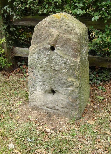
Image: © J & KS Taken: 9 Jun 2002
Stone post (plate lost) by the A426, in parish of Rugby (Rugby District), Dunchurch Road, by No. 194, South of Milestone Drive, North of and almost opposite Sedlescombe Park, on grass verge, on West side of road. Erected by the Rugby to Lutterworth turnpike trust in the 19th century. Inscription defaced for over a century. Carved benchmark on lower face, partially buried. Milestone Society National ID: WA_RGDN01
Images are licensed for reuse under creativecommons.org/licenses/by-sa/2.0
Image Location
Latitude
52.359793
Longitude
-1.269475