Old Milestone by the A379, Laira Bridge Road, Plymouth
Introduction
The photograph on this page of Old Milestone by the A379, Laira Bridge Road, Plymouth by T Jenkinson as part of the Geograph project.
The Geograph project started in 2005 with the aim of publishing, organising and preserving representative images for every square kilometre of Great Britain, Ireland and the Isle of Man.

There are currently over 7.5m images from over 14,400 individuals and you can help contribute to the project by visiting https://www.geograph.org.uk
Old Milestone by the A379, Laira Bridge Road, Plymouth
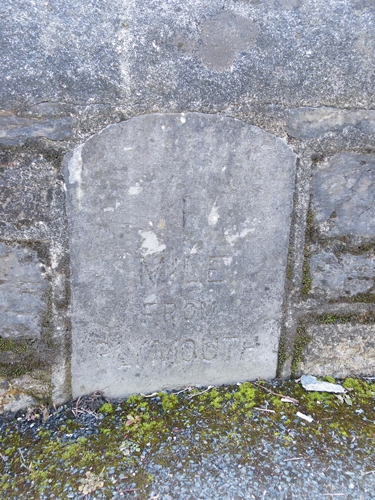
Image: © T Jenkinson Taken: 6 Oct 2006
Carved stone post by the A379, in parish of Plymouth (Plymouth District), Laira Bridge Road, by No. 56 and 58 flats, opposite the rear of Prince Rock Primary School, bottom of footbridge, flat in low wall, on South side of road. Embankment stone, erected by the Embankment Company turnpike trust in the 18th century. Inscription reads:- 1 MILE FROM PLYMOUTH Milestone Society National ID: DV_TNPL21
Images are licensed for reuse under creativecommons.org/licenses/by-sa/2.0
Image Location
Latitude
50.370946
Longitude
-4.116262