Old Boundary Marker by the A583, Peel Hill Bridge
Introduction
The photograph on this page of Old Boundary Marker by the A583, Peel Hill Bridge by Milestone Society as part of the Geograph project.
The Geograph project started in 2005 with the aim of publishing, organising and preserving representative images for every square kilometre of Great Britain, Ireland and the Isle of Man.

There are currently over 7.5m images from over 14,400 individuals and you can help contribute to the project by visiting https://www.geograph.org.uk
Old Boundary Marker by the A583, Peel Hill Bridge
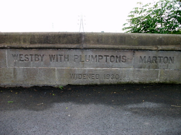
Image: © Milestone Society Taken: Unknown
Parish Boundary Marker by the A583, in parish of Westby with Plumptons (Fylde District), Peel Hill Bridge, opposite Maple Farm Nursery, in parapet on South side of road. Inscription reads:- WESTBY WITH PLUMPTONS | MARTON WIDENED 1930. Surveyed Milestone Society National ID: LA_BPPS05pb
Images are licensed for reuse under creativecommons.org/licenses/by-sa/2.0
Image Location
Latitude
53.786427
Longitude
-2.970281