Old Guide Stone by the B3254, Trefursdon, North Hill
Introduction
The photograph on this page of Old Guide Stone by the B3254, Trefursdon, North Hill by Milestone Society as part of the Geograph project.
The Geograph project started in 2005 with the aim of publishing, organising and preserving representative images for every square kilometre of Great Britain, Ireland and the Isle of Man.

There are currently over 7.5m images from over 14,400 individuals and you can help contribute to the project by visiting https://www.geograph.org.uk
Old Guide Stone by the B3254, Trefursdon, North Hill
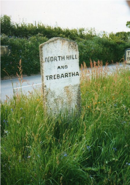
Image: © Milestone Society Taken: Unknown
Guide Stone by the B3254, in parish of North Hill (North Cornwall District), Trefursdon, 550m South of Congdon's Shop, on grass triangle. Inscription reads:- : LISKEARD / {<-arrow} : : NORTH HILL / AND / TREBARTHA : Carved benchmark on lower Liskeard face. Grade II listed. List Entry Number: 1249648 https://historicengland.org.uk/listing/the-list/list-entry/1249648 Surveyed Milestone Society National ID: CW_XNORT
Images are licensed for reuse under creativecommons.org/licenses/by-sa/2.0
Image Location


Leaflet Map data © OpenStreetMap
Latitude
50.574213
Longitude
-4.428732